This tutorial aims to guide users on using the Georastertools API and CLI.
Prerequisites
- Basic knowledge in image processing
Motivation
Georastertools gives acces to a CLI and API that allows to run various calculation tools :
- Computing radiometric indices on satellite images
- Computing the speed of evolution of image radiometry between two dates
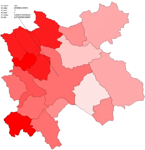
- Computing zonal statistics of the bands of a raster, i.e. statistics such as min, max, average, etc. on sub-areas (defined by a vector file) of the area of interest.
- Cropping a raster image into tiles following the geometries defined in a vector file
- Applying a convolutional filter (median, local sum, local mean, adaptive gaussian)
- Computing the Sky View Factor and shading for a DEM (Digital Elevation Model) raster.